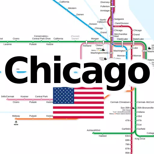
Discover the ultimate navigation tool for Chicago's transit system with our all-in-one application, featuring essential subway and railroad maps. This app is designed to enhance your travel experience, whether you're a local Chicagoan or a tourist exploring the city.
Our app offers offline access to the following line networks without any additional downloads:
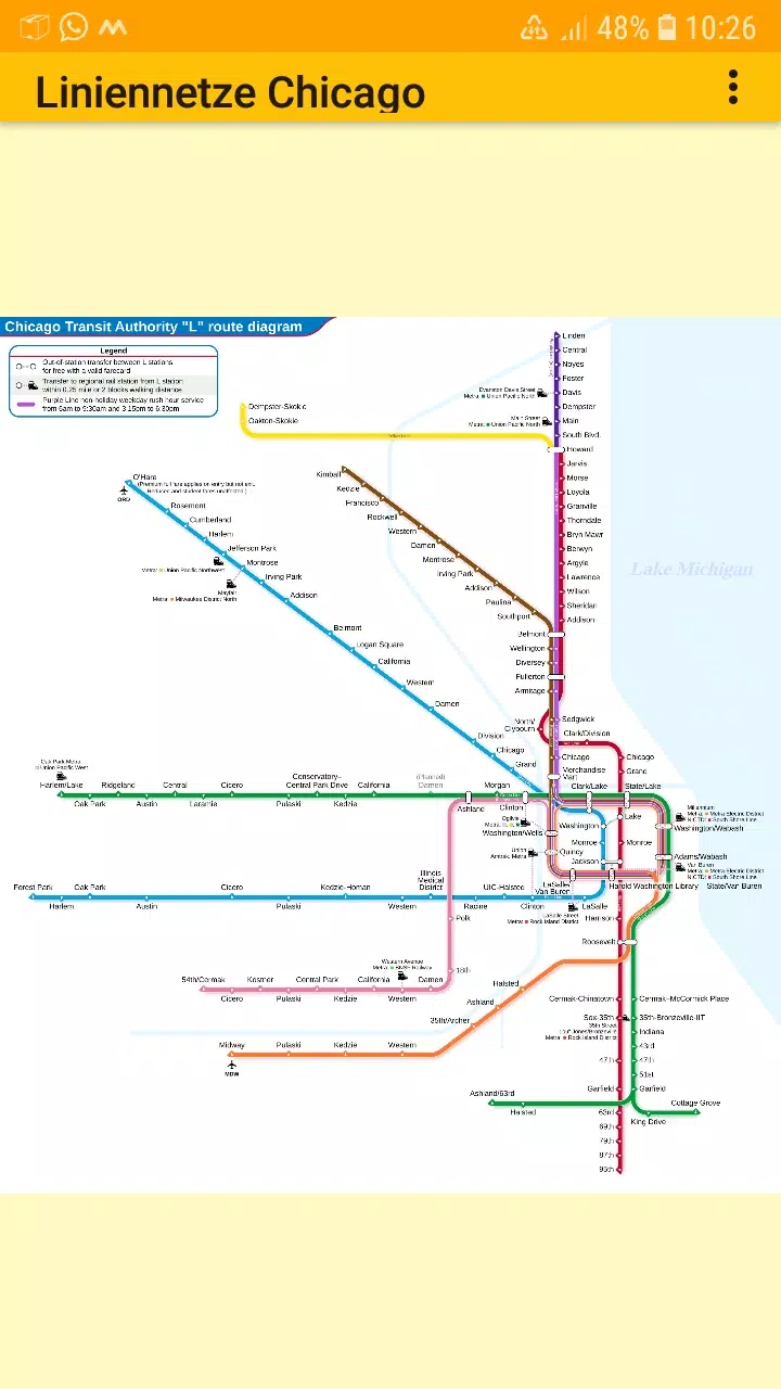
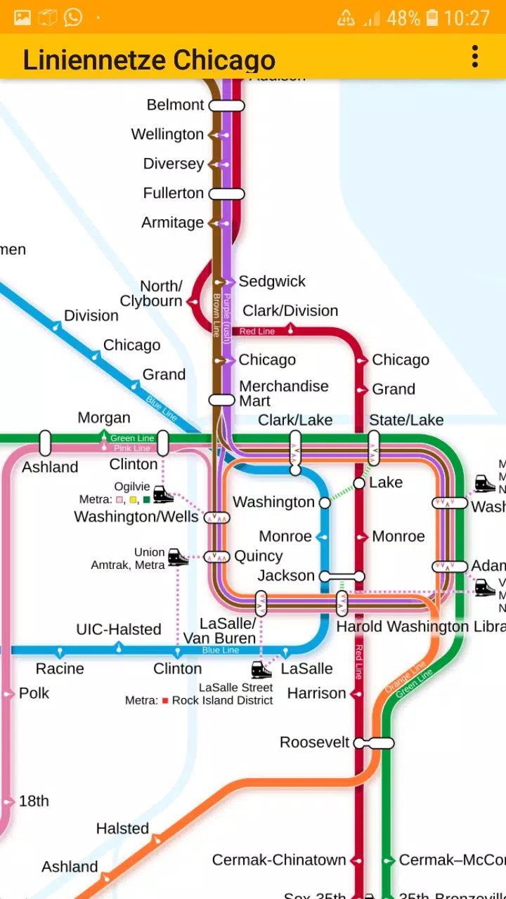
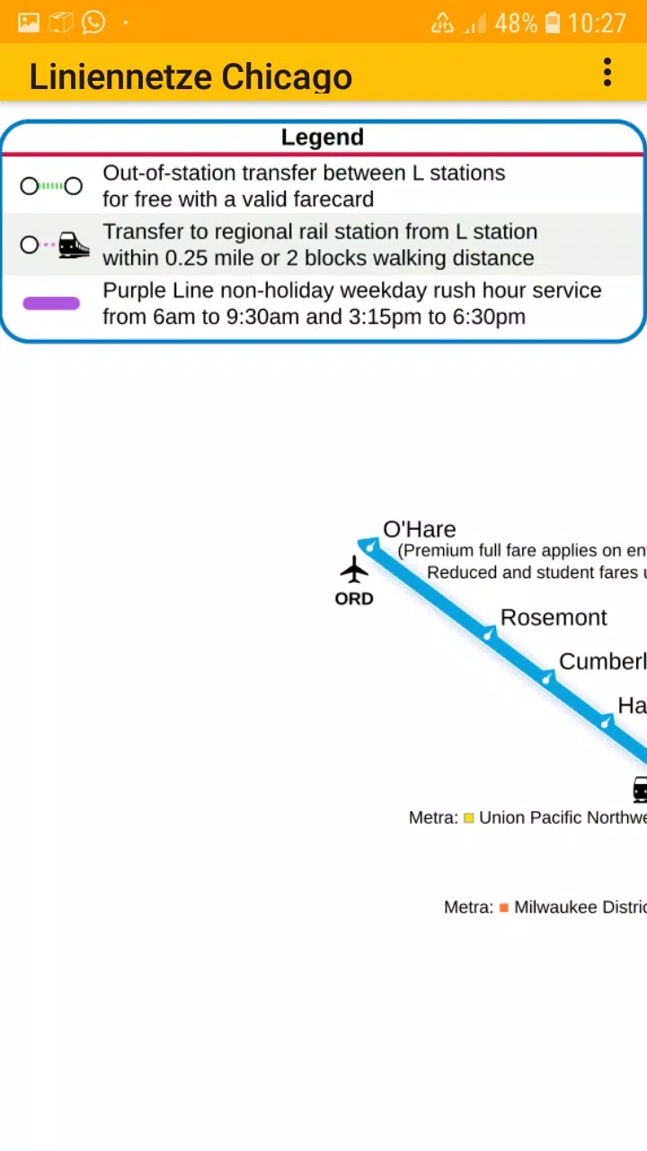
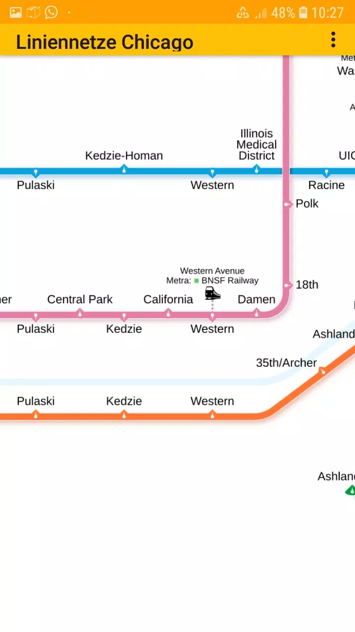
- Chicago elevated "L" rapid transit system
Stay connected with us on Facebook and visit our homepage for more information.
With easy-to-use, zoomable line network maps, our app is perfect for navigating the bustling transit system of Chicago. Simply scroll, zoom in, and zoom out to explore the maps offline. The app features multiple tabs, each dedicated to different types of transit maps, making it convenient to switch between them.
The metro line network, often referred to as the underground, rail transit map, urban tube map, or public subway, is comprehensively covered in our app. We value your input and welcome any suggestions for improvement, ideas, wishes, or feedback. You can reach out to us via email or through the contact form on our contact page.
Our app is compatible with phones and tablets running Android 4.4 (KitKat, API 19) up to Android 13.0 (API 33). Please note that while we strive to provide accurate and complete content, the information in the app is not guaranteed to be entirely accurate or up-to-date. The maps embedded in this app are licensed under Creative Commons (CC BY-SA 4.0) and were created by the Chinese Wikipedia user Sameboat, who holds the copyright.
Enjoy exploring Chicago's transit system with ease and convenience. Download our app on the Google Play Store, brought to you by dieEinsteiger.
What's New in the Latest Version 1.3
Last updated on Oct 20, 2024
v1.3 (06-08-2024)
- Update to Android API 35
Tags : Maps & Navigation