OfflineMaps provides you with a comprehensive selection of maps, ensuring you can explore without the hassle of waiting for them to load. With **no advertisements, no data sharing or monetization, no analytics, and no third-party libraries**, your experience remains private and uninterrupted.
Tired of waiting for maps to display? Use All-In-One OfflineMaps! Once the maps are displayed, they are stored and remain readily available, even without network access.
- **Want more than just roads on your maps?** You'll find everything you need here;
- **Used to go to places with poor network coverage?** Everything will stay accessible;
- **Used to go abroad?** You won’t be lost anymore;
- **Have a data allowance limit?** It will reduce your usage.
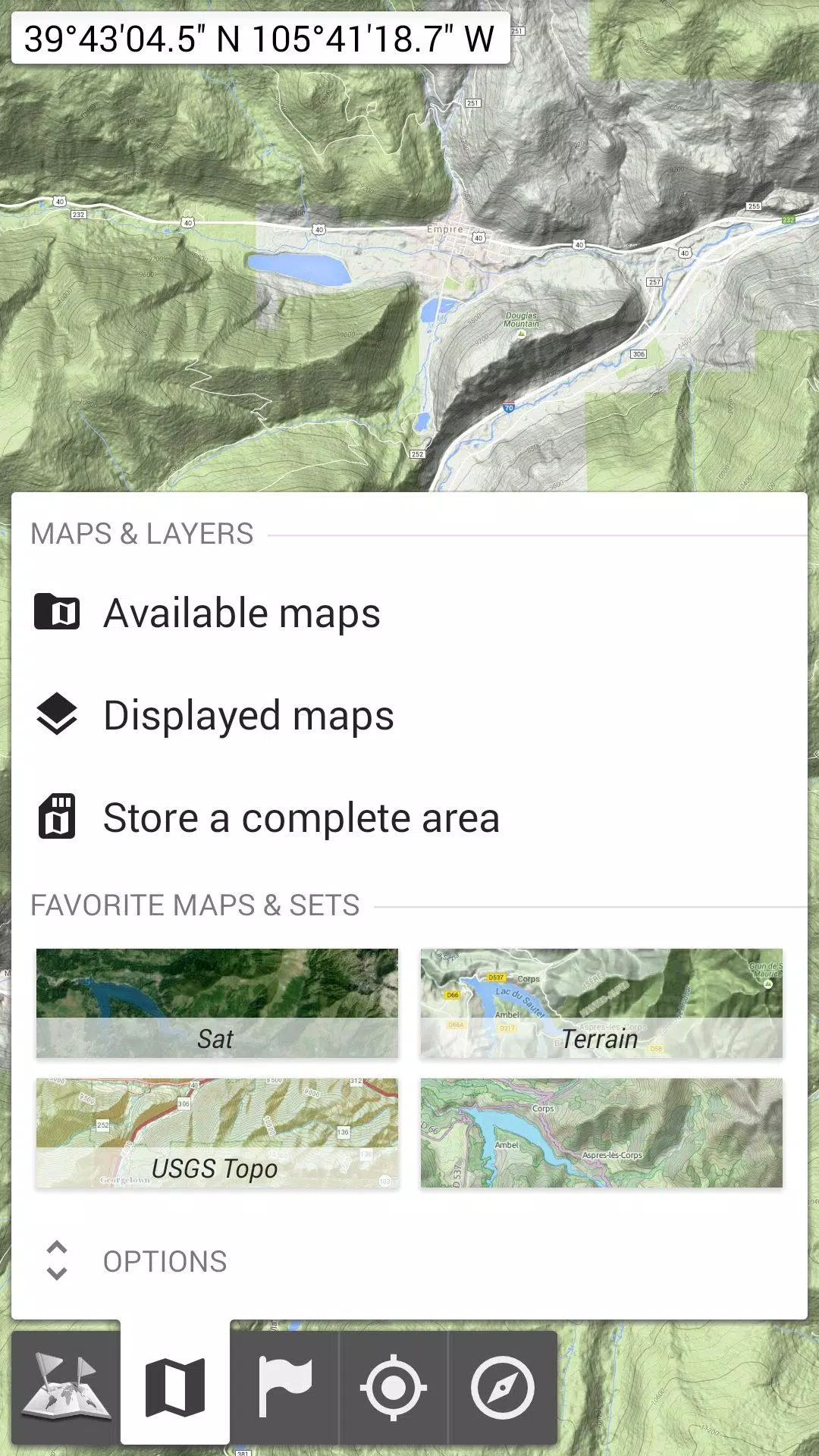
★★ Maps ★★
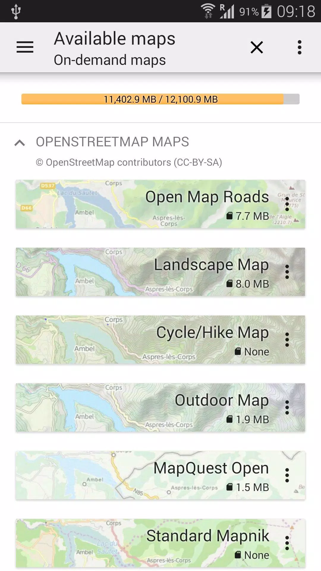
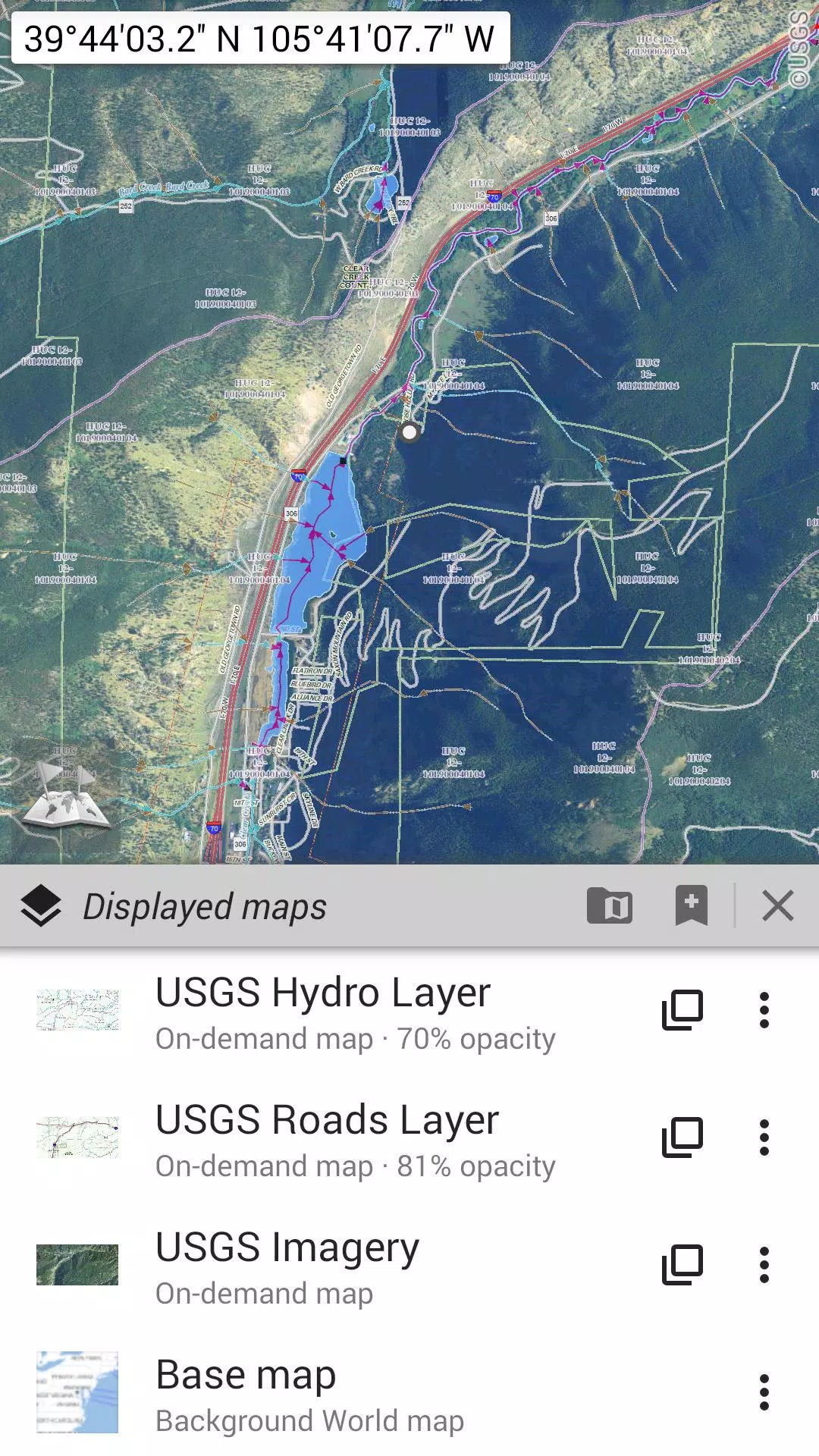
A wide variety of maps are at your fingertips, including classical road maps, topographic maps, aerial (satellite) maps, and various layers that can be overlaid on any map: OpenStreetMap (Roads, Topo), USGS National Map (Hi-res topo, Aerial imagery), Worldwide Military Soviet topo maps, and more.
- All maps can be stacked in layers, with precise opacity control;
- Select and store large areas with just a few clicks;
- Stored space is clearly managed and can be easily deleted.
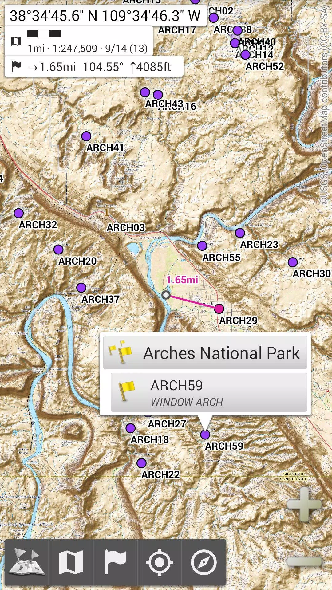
★★ Display, Store and Retrieve Unlimited Placemarks ★★
Enhance your maps by adding various items such as waypoints, icons, routes, areas, and tracks. Manage these effortlessly with the powerful SD-Card Placemarks Explorer.
★★ On-map GPS Location & Orientation ★★
Your real-time location and direction are clearly shown on the map, which can be rotated to match your actual orientation (depending on device capabilities). Easily turn this feature on or off to conserve battery life.
Additional features include:
- Metric, imperial, and hybrid distance units;
- GPS Latitude/Longitude and various grid coordinate formats (UTM, MGRS, USNG, OSGB Grid, Irish Grid, Swiss Grid, Lambert Grids, DFCI Grid, QTH Maidenhead Locator System, etc.);
- Ability to import hundreds of coordinate formats from https://www.spatialreference.org;
- On-map grids display;
- Full screen map view;
- Multi-touch zoom;
- ...
★★ Need More? ★★
If you're a true adventurer, consider trying **AlpineQuest Off-Road Explorer**, the complete outdoor solution built on All-In-One OfflineMaps, featuring a robust GPS Track Recorder and much more: https://www.alpinequest.net/google-play
Tags : Maps & Navigation